Kundiawa
Kundiawa is the capital of Simbu Province, Papua New Guinea, with a population of 8,147 (2000 Census). It lies along the Highlands Highway approximately halfway between Goroka and Mount Hagen, respectively the capitals of the Eastern Highlands and Western Highlands provinces.
Kundiawa is the centre of activity for people who are formally employed (which is a relatively small minority, because most people farm) but also for people who want to sell the coffee that they have grown, or to catch PMVs (public motor vehicles) to other towns. The busiest time in Kundiawa is every other Friday afternoon, because this is when everyone gets paid.
It is a relatively small town, containing a bank, a police station, one of the few airports in the province, several stores, a hospital, a post office, a second-hand market, two food markets and several churches. The Highlands Highway is the only paved road that leads out of it, but there are several smaller, unpaved roads, including one of the roads to Mount Wilhelm.
The Wahgi River runs along one side of Kundiawa, and the Simbu River, which runs on and becomes the Wahgi, flows along the other side. The terrain around Kundiawa is very steep and mountainous, and many people walk several kilometres each way to get to Kundiawa from their villages because they don't have access to roads.
Map - Kundiawa
Map
Country - Papua_New_Guinea
 |
 |
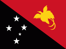
| Flag of Papua New Guinea | |
At the national level, after being ruled by three external powers since 1884, including nearly 60 years of Australian administration starting during World War I, Papua New Guinea established its sovereignty in 1975. It became an independent Commonwealth realm in 1975 with Elizabeth II as its queen. It also became a member of the Commonwealth of Nations in its own right.
Currency / Language
| ISO | Currency | Symbol | Significant figures |
|---|---|---|---|
| PGK | Papua New Guinean kina | K | 2 |
| ISO | Language |
|---|---|
| EN | English language |
| HO | Hiri Motu language |


